By Sierra Fullmer
Many beach goers love to watch coastal animals resting, playing, and swimming along the shoreline, including my typical study species, the southern sea otter. However, some species are much harder to find and require extensive efforts to see them, even for the experts! During the months of August and September I worked with a small team of scientists from NOAA and the affiliated organizations Upwell Turtles and Moss Landing Marine Laboratory to survey the Oregon and Washington coastline and locate, capture, and gather valuable information on the endangered leatherback sea turtle.
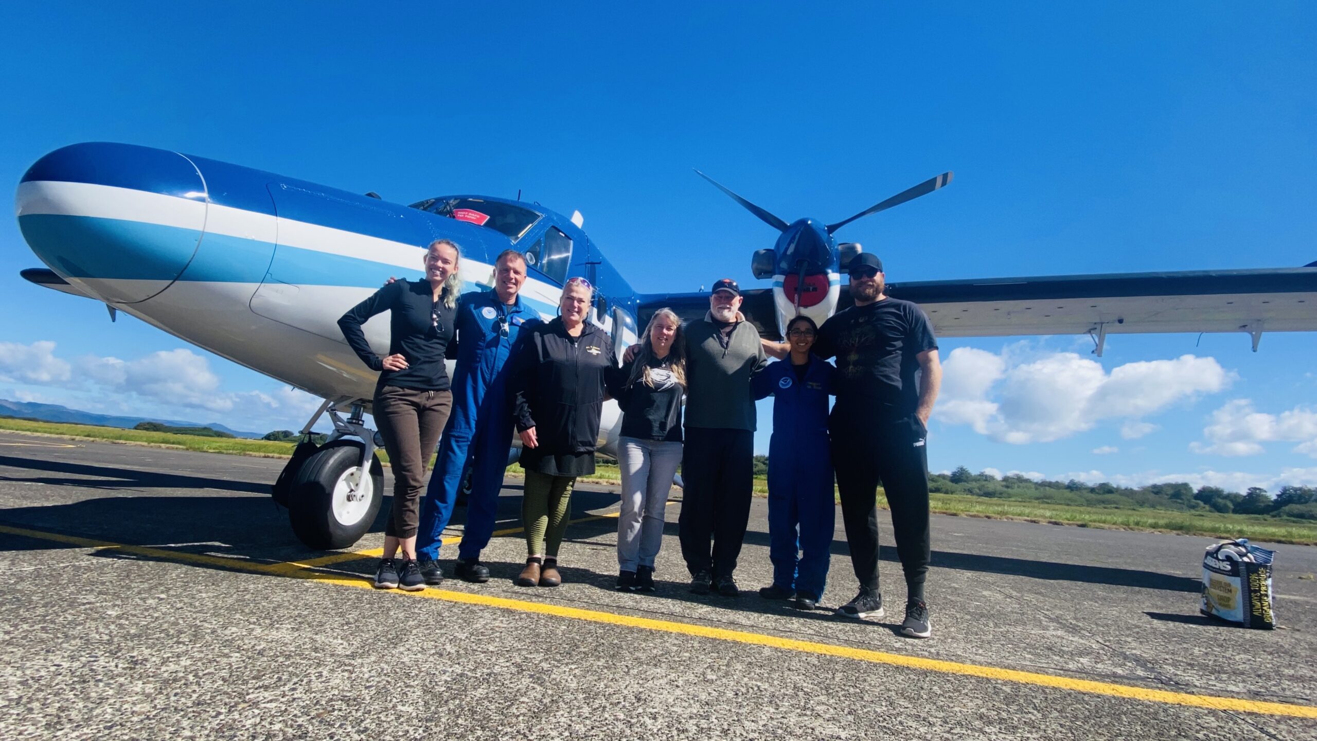
Aerial survey team in front of the Twin Otter observation plane. People from left to right: Sierra Fullmer, Nick Toth (NOAA pilot), Katherine Whitaker, Karin Forney, Scott Benson, Priti Bhatnagar (NOAA pilot), Garrett Lemons. Not pictured: Vicky Vasquez and NOAA pilots Conor Maginn and Kennieth Brewer. Photo credit: Garrett Lemons
As a part of the aerial team, I assist with locating these five- to six-foot, 800- to 1400-pound leatherback turtles, but it’s not as easy as it may seem!
My role as an aerial observer involves scouring the seas for any signs of turtle habitat, food, and other associated species - plus on our very best days the turtles themselves! The Western Pacific leatherback sea turtle population has declined by approximately 80 percent since the 1980’s1,2. Leatherbacks face challenges all throughout their lives. Although they are largely protected at their primary nesting beaches, they still face threats at secondary nesting beaches, where adults are occasionally still harvested, and eggs poached. Upon leaving their nesting grounds, juvenile and adult leatherback turtles face a maze of fisheries as they pass through the Exclusive Economic Zones (EEZs) of many fishing nations and international waters while traversing the entire Pacific Ocean to reach the western coastline of North America. Once in North American coastal waters, adult leatherbacks spend the summer and fall months feeding on blooms of jellyfish that annually occur with upwelling events of cold, nutrient-rich water being drawn to the ocean surface1. How these leatherbacks select and re-locate these patches year after year is still unknown, and part of what we hope to investigate with our surveys. But fear not, we have figured out some clues to help us in our search.
On “fly-days” our lead researchers Scott Benson and Dr. Karin Forney have undergone intense weather monitoring and decided we face good wind and cloud conditions that should provide calm, white-cap-free waters. In our ideal weather days, the waters are so calm that we can see the airplane’s reflection on the water from 650 feet in the air! Once we get the go-ahead, we pile into our cars, head to the airport to meet our NOAA pilots, and prepare our recording equipment before strapping in and taking off!
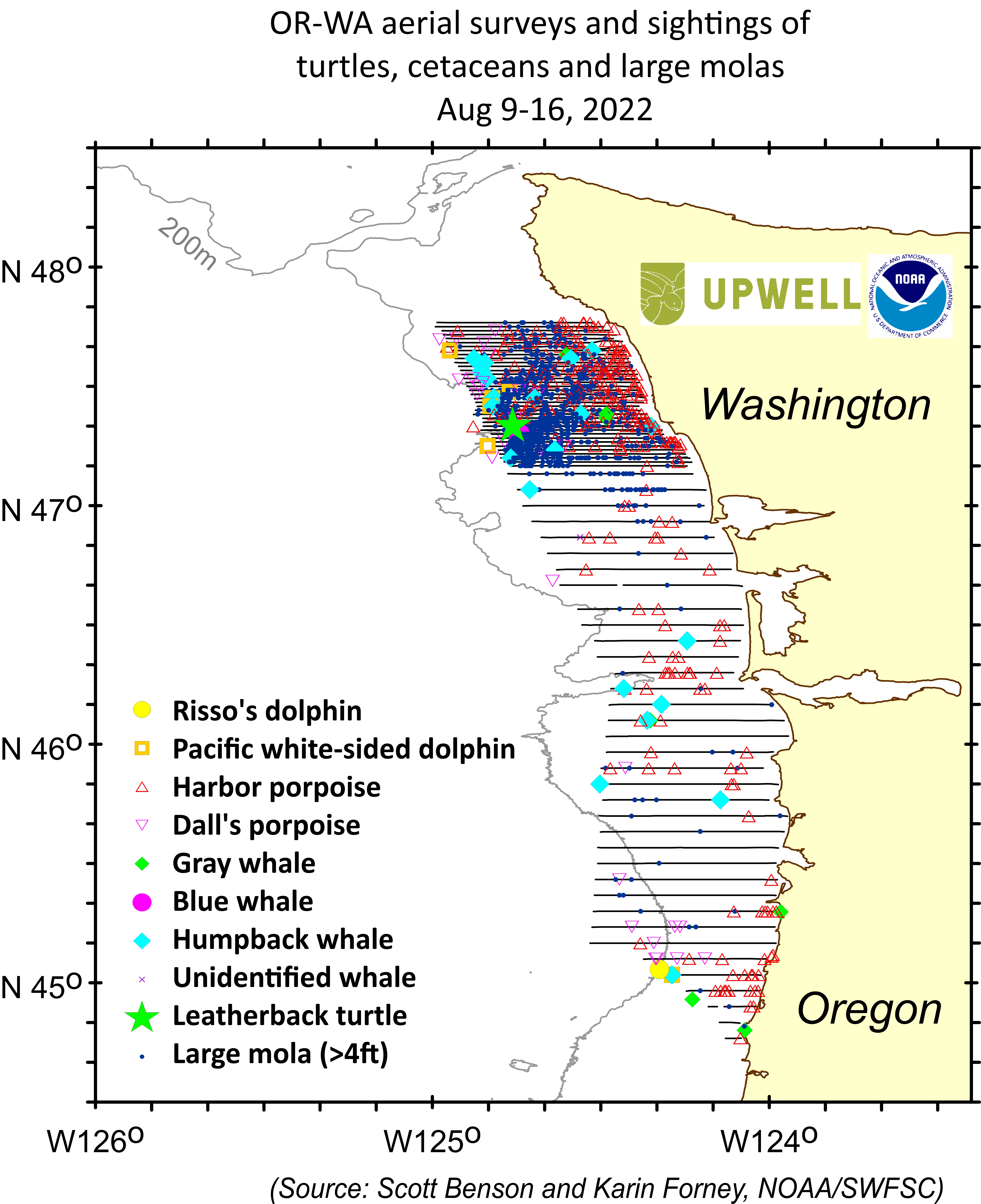
On our first few flights, we hoped to get a coarse understanding of the environment along the Oregon and Washington coastlines and to identify areas where we might have the best luck turtle-spotting. Over the course one week, we spent 28 flight hours flying transect lines that extended from Newport, Oregon to just south of La Push, WA. With these long flight days, we collected data on water conditions, jellyfish blooms, and marine species presence within 25-30 miles of the coast. Our initial transects were spaced every four miles of latitude, which narrowed to a more fine-scaled 1-mile spacing as we focused in on the main target area. Non-turtle species data we collect not only assists with our project but can also be used in other studies such as harbor porpoise population surveys.
But how did we get this information? We stuck our faces (almost) out of the plane of course! But not how you might think...
For these surveys we are flying a specially modified Twin Otter plane owned by NOAA that has a large “bubble window” on either side just behind the pilots and an additional belly window in the back of the plane. These windows combined allow our observers an almost 180-degree view of the water below! While surveying, each observer spends approximately 45 minutes sticking their entire head and shoulders into the windows and calling out every species of animal they see. Then when you finally start to feel a kink in your neck and think you may never make it out of the window, you rotate! My personal favorite spot in the plane is the belly window, where you lay in the back of the plane, stick your head into the small window, and watch the water, algae, and animals as you fly by. If you’re lucky enough to be in the belly on a perfect day, you can even spot your own reflection hundreds of feet below!
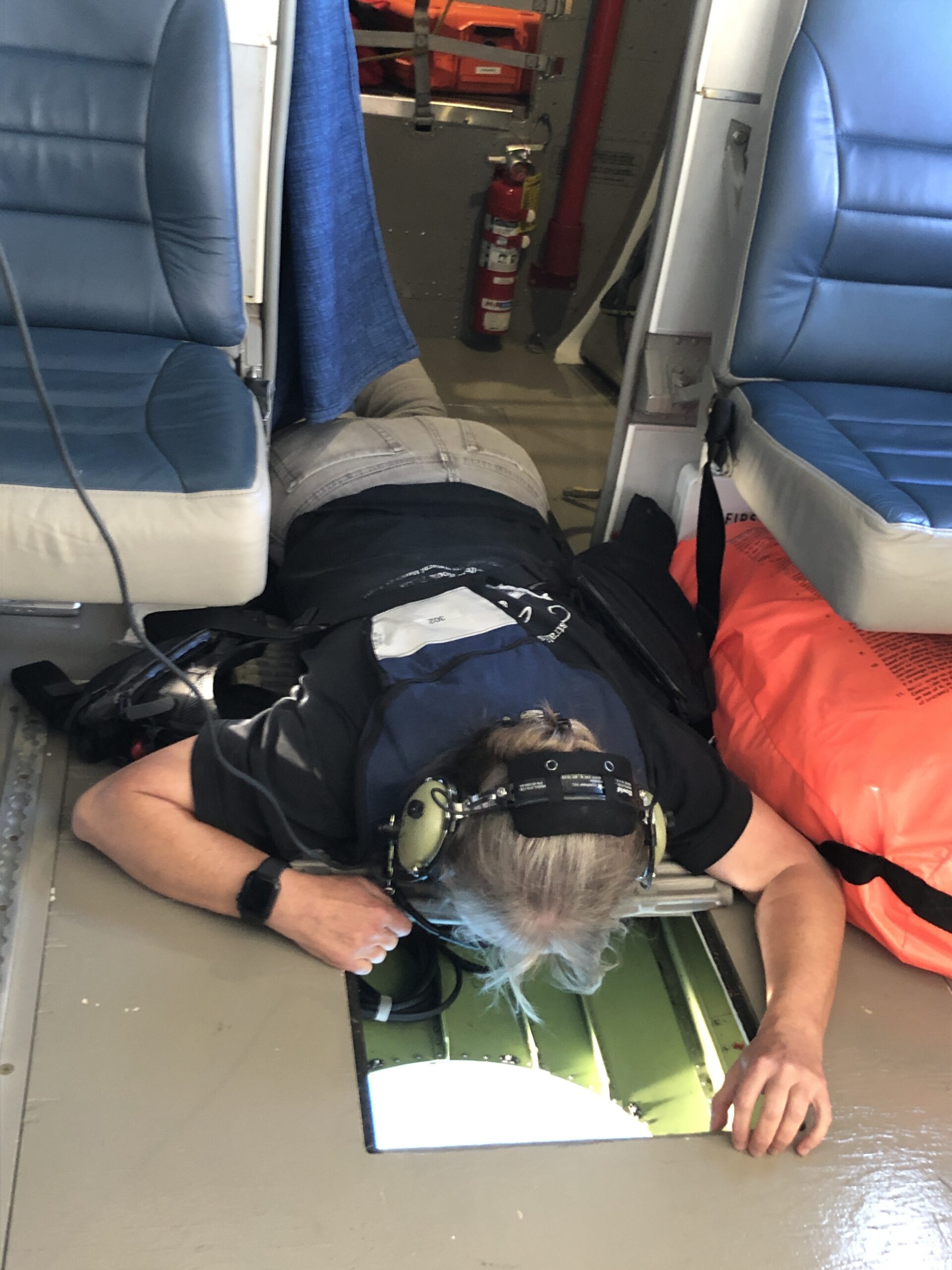
Lead scientist Karin Forney looking out through the belly window mid-survey.
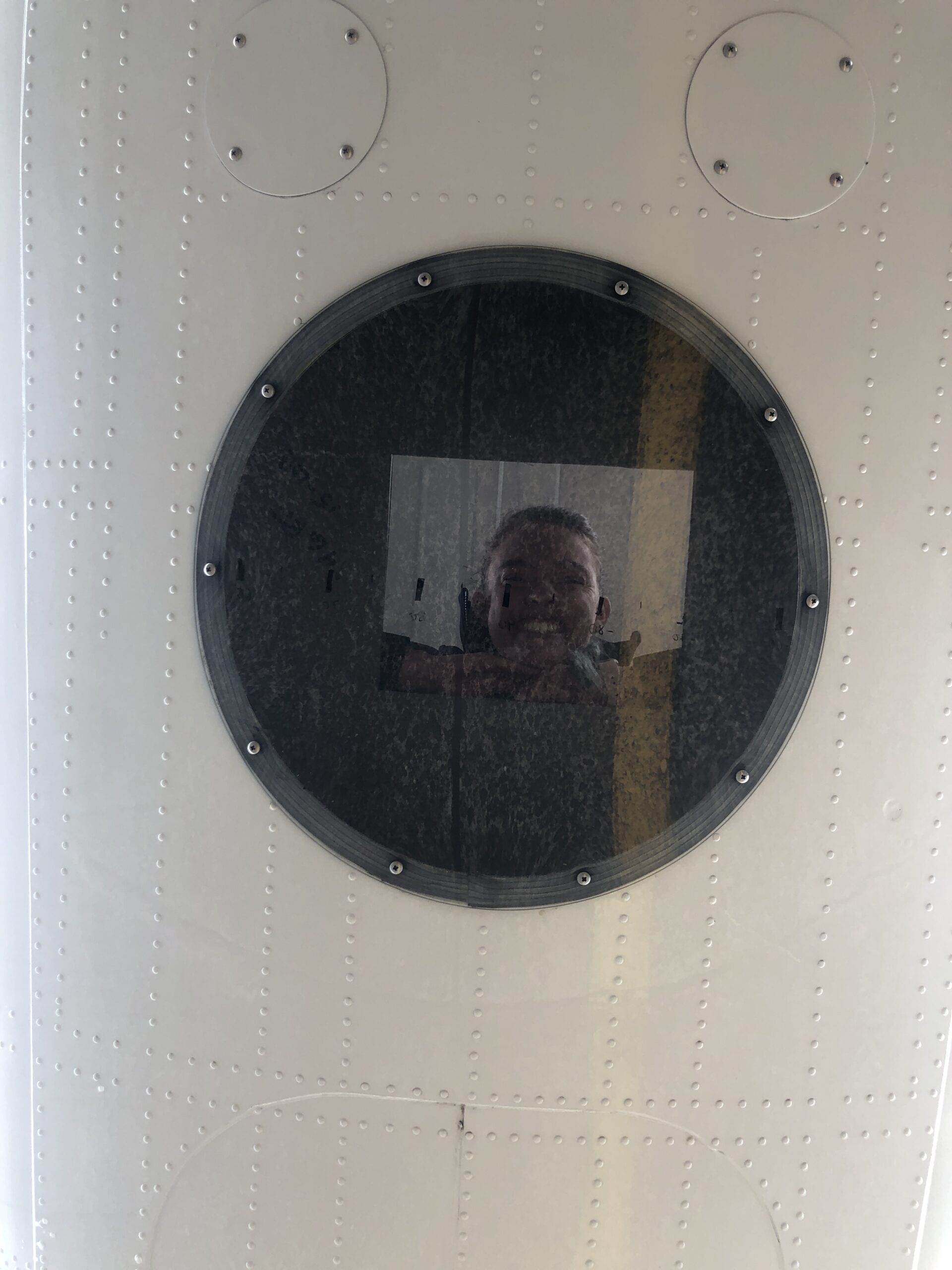
An external view of aerial observer, Sierra Fullmer, looking through the belly window. Image was taken from below while the plane was parked on the tarmac.
Although these views sound glamorous, much of our time is spent looking through sun glare, counting tens to hundreds of animals (sometimes in the span of a few minutes), and making sure you don’t lose focus waiting to find the elusive turtle hidden amongst the algae and ocean sunfish (Mola molas).
Over the last several years of leatherback research, a trend has appeared that leatherbacks are often found in association with dense aggregations of large Mola mola, or ‘molas’, as we call them for short. Large molas are typically four to eight feet in diameter or longer and feed on the same food as leatherback sea turtles: blooms of jellyfish species including brown sea nettles (Chrysaora fuscescens) and moon jellies (Aurelia spp). While flying over the water, when we hit an area of ‘Mola mayhem’ it’s a period of excitement, focus, and a little bit of insanity – especially for the data recorder. I had the eye-opening experience of data recording through my first section of ‘Mola mayhem’ during this field season, where every observer was calling out mola sizes and numbers every second and my entire job was to record them on our digital data log as fast (and accurately) as possible. My fingers were flying so fast I even knocked a key off the keyboard! Don’t worry though, I replaced it at the end of the mayhem.
To get an idea of the mayhem picture this, you’re standing in the middle of an auction house where three different auctioneers are calling out their bids at the same time and your job is to write down everything each auctioneer is saying simultaneously and correctly. Mayhem is the only description. However, it’s extremely important data to collect to really narrow down where our turtle habitat may be, as this helps us find the few leatherbacks that are still making it through the maze of fisheries to our coastlines each year. The proof is in the results.
At the end of our third survey day, with only an hour of fuel left, our team was flying through Mola mayhem calling out large molas left, right, and center when the belly observer calmly called out “turtle” and all chatter stopped for what felt like the longest second. In this time, our pilots and data recorder marked the coordinates as fast as possible, and everyone instantly went on high alert. This was our chance. The pilots circled back, once more flying over the area while every observer was trying to look past the glare of the sun sitting low on the horizon. The pilot started a count down, “You should see it in three…two… one…” and to our amazement the turtle popped out of the glare. The entire crew erupted with excitement and started calling out directions, “turtle at your nine-o’clock, just under the wing!” We managed to circle it for approximately 15 minutes, relocating it between shallow dives and getting a good look to confirm there was no tail (which means it was not an adult male). It was a large, round female and our first aerial sighting in the Pacific Northwest since 2011!
It was the perfect ending to what had been my longest day of flying so far, and a sense of hope for the rest of our survey efforts. Now that we know where to find ‘turtle water’, we have our zone of Mola mayhem, and we know there’s still turtles out there, we hope we can find more turtles for Stage 2: boat capture and tagging. Hopefully I’ll have more updates for you all at the end of the field season, until then I’ll be one pair of the eyes in the sky!
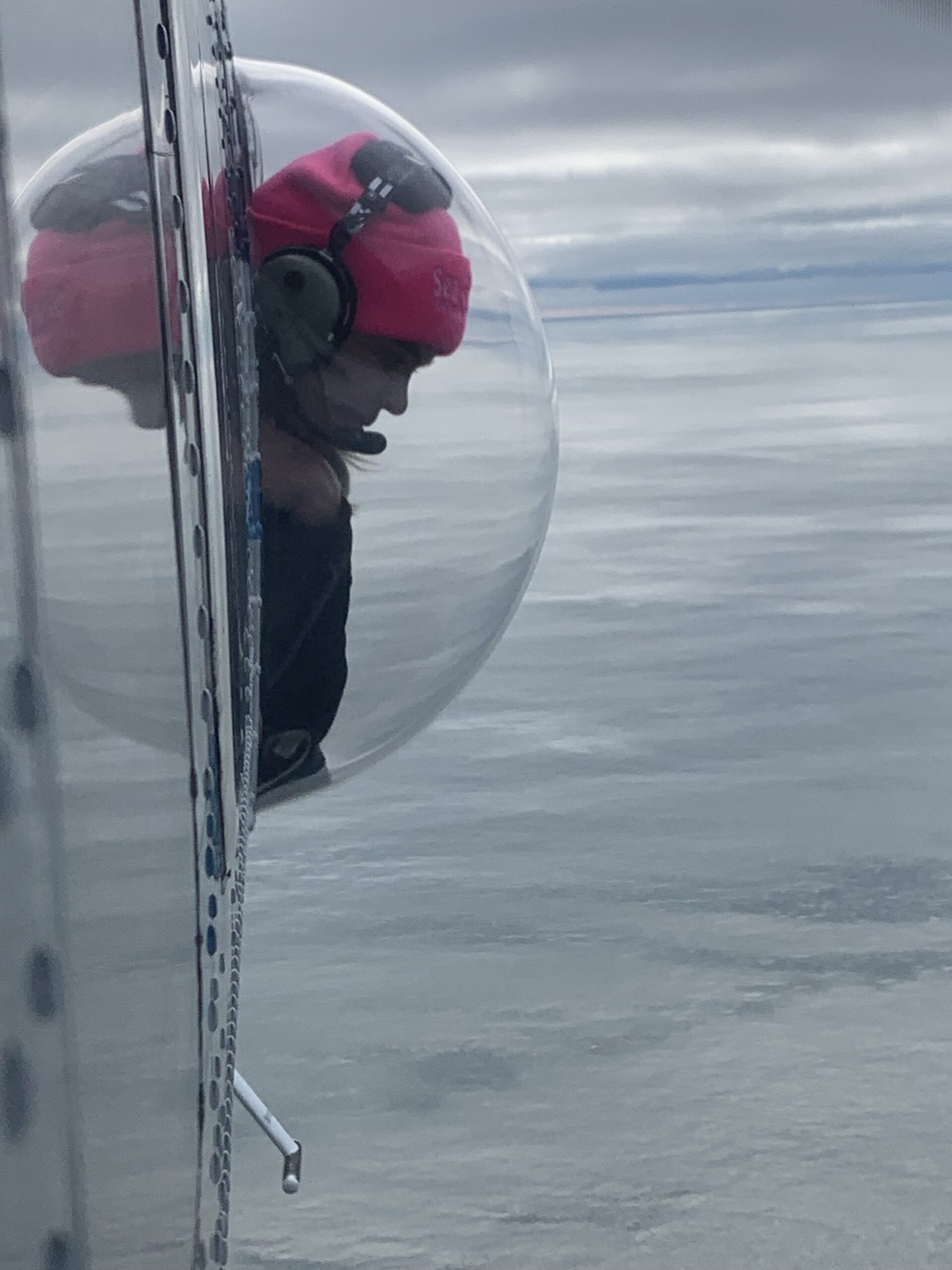
Aerial observer, Sierra Fullmer, looking out the bubble window during a survey, watching the glassy ocean surface passing below. Photo credit: Karin Forney
References
- Benson SR, Eguchi T, Foley DG, Forney KA, Bailey H, Hitipeuw C, Samber BP, Tapilatu RF, Rei V, Ramohia P, Pita J, Dutton PH. 2011. Large-scale movements and high-use areas of western Pacific leatherback turtles, Dermochelys coriacea. Ecosphere. 2(7):art84. doi:10.1890/ES11-00053.
- Benson SR, Forney KA, Moore JE, LaCasella EL, Harvey JT, Carretta J V. A long-term decline in the abundance of endangered leatherback turtles, Dermochelys coriacea, at a foraging ground in the California Current Ecosystem. Glob Ecol Conserv. 2020;24:e01371.
- Tapilatu RF, Dutton PH, Tiwari M, Wibbels T, Ferdinandus H V, Iwanggin WG, et al. Long‐term decline of the western Pacific leatherback, Dermochelys coriacea: a globally important sea turtle population. Ecosphere. 2013;4:1–15.

