
Mapping Tools
A list of web mapping tools to explore projects, view CRAM scores, evaluate SLR, etc.
California Rapid Assessment Method (CRAM)
Link: cramwetlands.org
The California Rapid Assessment Method is an assessment tool that provides information about the condition of a wetland and the stressors that affect it. Moss Landing Marine Laboratories, the California Coastal Commission, and the Central Coast Wetlands Group have calibrated the tool in the central coast. The Central Coast component of CRAM is part of a larger effort led by the San Francisco Estuary Institute and Southern California Coastal Water Research Project.
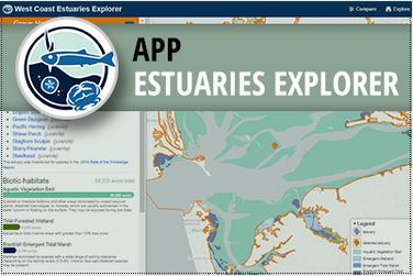
PMEP West Coast Estuaries Explorer
This application is useful for quickly comparing estuaries to each other along the coastlines of Washington, Oregon, and California. Using dynamic filters and an interactive map you can find estuaries that meet specific criteria; or estuaries that provide habitat for focal species of interest to you.
California Aquatic Resources Inventory (CARI)
CARI is a Geographic Information System (GIS) dataset of surface waters and their riparian areas consisting of polygon and line features with data-rich attributes that can be used for developing broad- or fine-scale landscape summaries of aquatic features. CARI is a seamless statewide map compiled from multiple data sources and standardized to a common classification system. This statewide dataset provides the best available map of state surface waters and serves as the base map in EcoAtlas to coordinate monitoring and assessment at the landscape scale across federal, state, and local agencies, while providing enough detail to inform local land use planning.
SIMoN Interactive Maps
The Sanctuary Integrated Monitoring Network (SIMoN) has several useful interactive maps that hold a huge amount of information on water quality monitoring, ocean habitat and west coast observatories in and around the Monterey Bay National Marine Sanctuary.
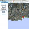
MPA Interactive Web Map
The CDFW Interactive Web Map is an interactive map allowing users to access regulations and maps, and further explore California MPAs
![]()
California EcoAtlas-Central Coast
The Central Coast Wetlands Group has populated EcoAtlas (formerly Wetland Tracker) with information on restoration projects through out the central coast. The information includes location, size, habitat, and status of central coast restoration, enhancement, and creation projects.
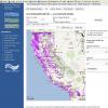
Conservation Lands Network Explorer
The Conservation Lands Network is a multi-year science-based study by over 125 organizations and individuals tasked to identify the most essential lands needed to sustain the “natural infrastructure” of our region -- a functioning web of life that gives us freshwater, wildlife, local food, fresh air and beautiful places
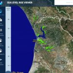
NOAA SLR Viewer
Use this web mapping tool to visualize community-level impacts from coastal flooding or sea level rise (up to 10 feet above average high tides). Photo simulations of how future flooding might impact local landmarks are also provided, as well as data related to water depth, connectivity, flood frequency, socio-economic vulnerability, wetland loss and migration, and mapping confidence.
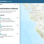
California Coastal Resilience Mapping Portal
The US Coastal Resilience tools provide support for decision-makers working in the continental US identify solutions for risk reduction and conservation. They build from critical resources provided by many groups and agencies including NOAA, USGS, FEMA, USFWS, TNC and the Natural Capital Project.

California Gage Analysis Priority Watersheds Tool
The tool allows interested parties to explore the California Stream Gaging Prioritization Plan’s recommendations to improve and expand the State’s gaging system, watersheds identified with high-priority water management needs, and long-term stream gages whose data is publicly available in an interactive map-based format. The Tool currently incorporates gages found on the U.S. Geological Survey's National Water Information System (NWIS) and the Department of Water Resources' California Data Exchange Center (CDEC).
California Nature
CA Nature: a suite of interactive mapping and visualization tools compiling statewide biodiversity, access, climate and conservation information to advance 30x30.
California 303 (d) impaired waterbodies
This very important mapping tool provides users with information on water quality impairments across the State. On October 11, 2011, EPA issued its final decision regarding the waters EPA added to the State's 303(d) list, which can be viewed here.
Santa Cruz Water Quality
This site displays the most recent water quality data available for Santa Cruz. In some cases sites are not all sampled on the same day.