Seafloor Mapping
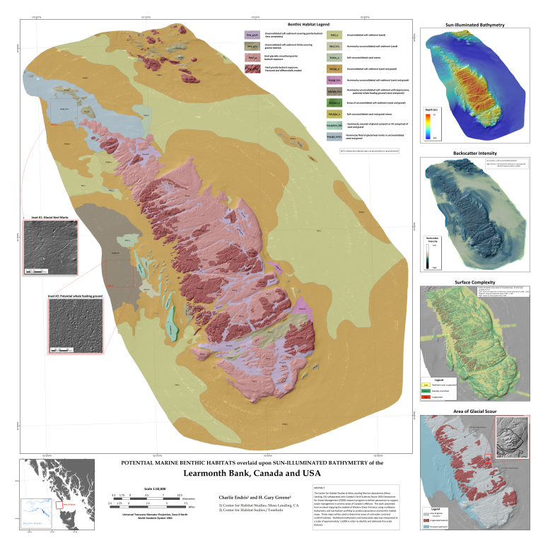
2008: Learmonth Bank Potential Benthic Marine Habitat Map
The Center for Habitat Studies at Moss Landing Marine Laboratories (Moss Landing, CA) collaborated with Canada’s Earth Sciences Sector (ESS) Geoscience for Ocean Management (GOM) research program to deliver geoscience to support ocean management in priority areas of Canada’s offshore. The work presented here involved mapping the seabed of Western Dixon Entrance using multibeam bathymetry and sub-bottom profiling to produce geoscience and benthic habitat maps. These maps will be used to determine areas of cold water coral and rockfish habitats. Multibeam bathymetry and backscatter data was interpreted at a scale of approximately 1:3,000 in order to identify and delineate fine-scale features.


2008-2015: California Seafloor Mapping Program (CSMP)
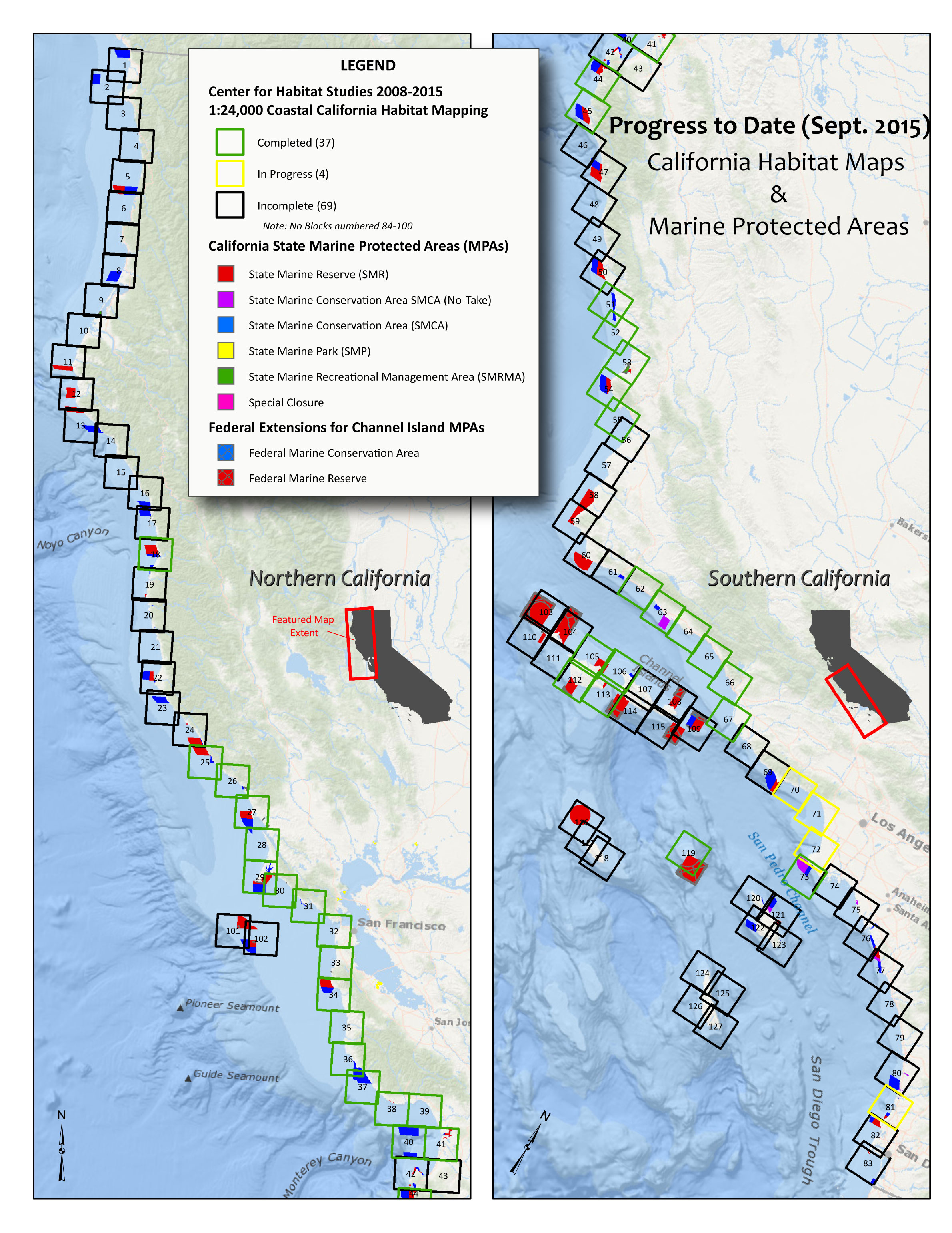
From 2008 to 2015, the Center for Habitat Studies collaborated with the US Geological Survey and the California Ocean Protection Council to create benthic marine habitat maps for approximately 34% of the California coastline extending to 3 nautical miles offshore (i.e., “state waters”). All maps and accompanying information and metadata have been incorporated into the CSMP web portal: http://walrus.wr.usgs.gov/mapping/csmp/
Map showing the extent of all benthic marine habitat maps produced by the Center for Habitat Studies.


